
9:47 p.m.
From: Lorenzo Sanchez
Sent: Tuesday, May 27, 2014 4:27 PM
To: Be Prepared
Subject: EM Alert: Tornado Watch for Bexar County Until 11 pm
UTSA Preparedness Partners,
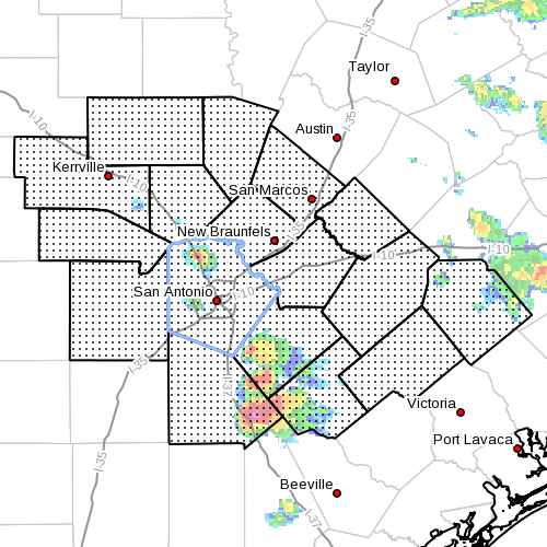
The National Weather Service has issued a Tornado Watch for Bexar County and the
surrounding areas from 3:40 pm - 11:00 pm today. A watch means conditions are favorable
for the development of tornadoes within our area throughout the awareness period.
Additionally, the NWS advises hail and damaging winds may accompany developing storms.
Rainfall of 1 - 3 inches may be possible in localized areas with the threat of flooding.
Please review the full NWS discussion below.
UTSA Protective Measures:
* Actively monitor local news and weather stations/websites for the latest
information and radar data.
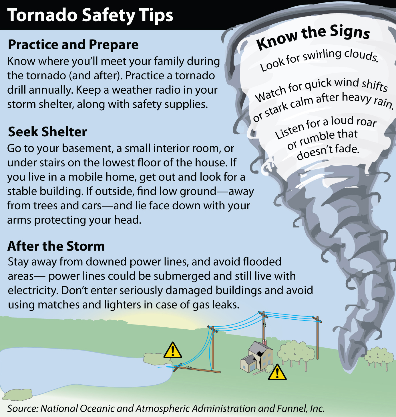
* Tornado preparedness:
o Stay away from windows.
o Seek shelter on the lowest floor and an interior room, bathroom, closet, and/or
hallway - avoid glass windows.
o Protect your body from debris, cover your head.
o Do not go outside to your car.
* Keep your emergency kit available, including personal belongings.
* Stay alert of your surroundings and keep an eye to the sky.
Resources:
* National Weather Service -
www.weather.gov/sanantonio<http://www.weather.gov/sanantonio>
* FEMA Tornado Ready & Tips -
www.ready.gov/tornadoes<http://www.ready.gov/tornadoes>
* Campus Alerts - www.alerts.utsa.edu<http://www.alerts.utsa.edu>
Should conditions warrant, additional information will be distributed. Please continue to
monitor local news stations and the NWS for the latest information on watches and
warnings. Be safe UTSA!
______________________________
Lorenzo D. Sanchez, MPA, CEM
Director of Emergency Management
The University of Texas at San Antonio
University Police Department
Office of Emergency Management
One UTSA Circle
San Antonio, Texas 78249
Phone: (210) 458-6756
Fax: (210) 458-7602
Email: lorenzo.sanchez@utsa.edu<mailto:lorenzo.sanchez@utsa.edu>
Website: www.utsa.edu/utsapd<http://www.utsa.edu/utsapd>
Campus Alerts: http://alerts.utsa.edu/
From: Jon Zeitler [mailto:jon.zeitler@noaa.gov]
Sent: Tuesday, May 27, 2014 2:43 PM
Subject: Tuesday 245 pm Weather Update...Threat for Heavy Rain and Severe Storms
Continues
South Central Texas Partners...
...HEADLINE...Periods of showers and thunderstorms will continue from this afternoon
through Wednesday morning.
...AREA OF CONCERN...Severe storms possible west of U.S. 281, but the best chances for
severe storms and minor flooding are east of U.2. 281 tonight through noon Wednesday.
...IMPACTS...Severe storms may produce large hail and damaging winds. There is only a very
small chance for weak tornadoes. The much better chance is for rainfall of 1-3 inches in
spots, which will produce minor flooding (underpasses, typical low-lying spots). A number
of creeks and rivers are running near bankfull, so additional rain may cause them to go
into minor flood stage.
...TIMING...Scattered showers and thunderstorms will continue across the eastern half of
the area this afternoon. Some storms may move off the Mexican mountains and affect the Rio
Grande Plains late this evening. An organized cluster of storms is forecast to develop
near Waco after midnight and move south-southeast. This cluster may move across locations
along and north of Texas Highway 71 between 4 and 8 am Wednesday morning.
...CONFIDENCE...Moderate.
...DISCUSSION...A large upper low continues to move slowly eastward along the Red River.
Moist Gulf air and instability will combine with the low to maintain scattered showers and
thunderstorms across the area through Wednesday. While the ingredients are close to
minimal thresholds for severe storms, they are in place and would most likely produce
damaging winds and large hail. A weak tornado is also possible. A weak east-west boundary
will help to focus the storms over the northeastern quarter of our area -- generally along
and north of Texas Highway 71, including Metro Austin. Individual storm cells may slide
from west to east along the boundary as the overall cluster of storms moves south,
resulting in training of cells over some locations, and the potential for 1 to 3 inches of
rain. This amount of rain would fall within 1-2 hours, and thus may produce minor flash
flooding. There will be a small chance of afternoon thunderstorms Wednesday afternoon
through Saturday, but neither severe storms, nor heavy rain are expected.
You can see the latest forecasts and watches/warnings/advisories by going to the
Austin-San Antonio National Weather Service website at
www.weather.gov/austin<http://www.weather.gov/austin>
Jon Zeitler
National Weather Service Austin-San Antonio TX
[cid:image001.jpg@01CF79C4.6506D050]
4329
days inactive
4329
days old
0 comments
1 participants
participants (1)
-
 advising@lists.sis.utsa.edu